
If you’re looking for a hiking trail near Port d’Andratx, where you can hike through a stunning cliff-side forest down to a wild and otherwise inaccessible cala beach, then the hiking trail to Cala d’Egos on the western side of Mallorca is for you.
Cala d’Egos, near Port d’Andratx, is a remote beach in a secluded cove that is completely inaccessible by road – the only way to reach it is via this cliff-side forest hike or by boat – meaning none of the crowds of tourists you might encounter on the more popular beaches of the island, as well as mind-blowing views of one of Mallorca’s most beautiful natural regions.
Note that there are two Cala d’Egos on Mallorca – one is over to the east, close to Cala d’Or and Santanyi, so don’t get confused and head to that one as it’s a completely different experience.
The Cala d’Egos we visited here is to the west, just a few minutes outside of Port d’Andratx (there’s a Google Maps link at the bottom of the page).
The start of this Port d’Andratx hiking trail to Cala d’Egos is about 10-minutes’ drive up the tree-lined hillside from Port d’Andratx (full directions to the start of the trail are below).
We parked our car in a space at the roadside and headed uphill via a rocky path leading up into the forest.
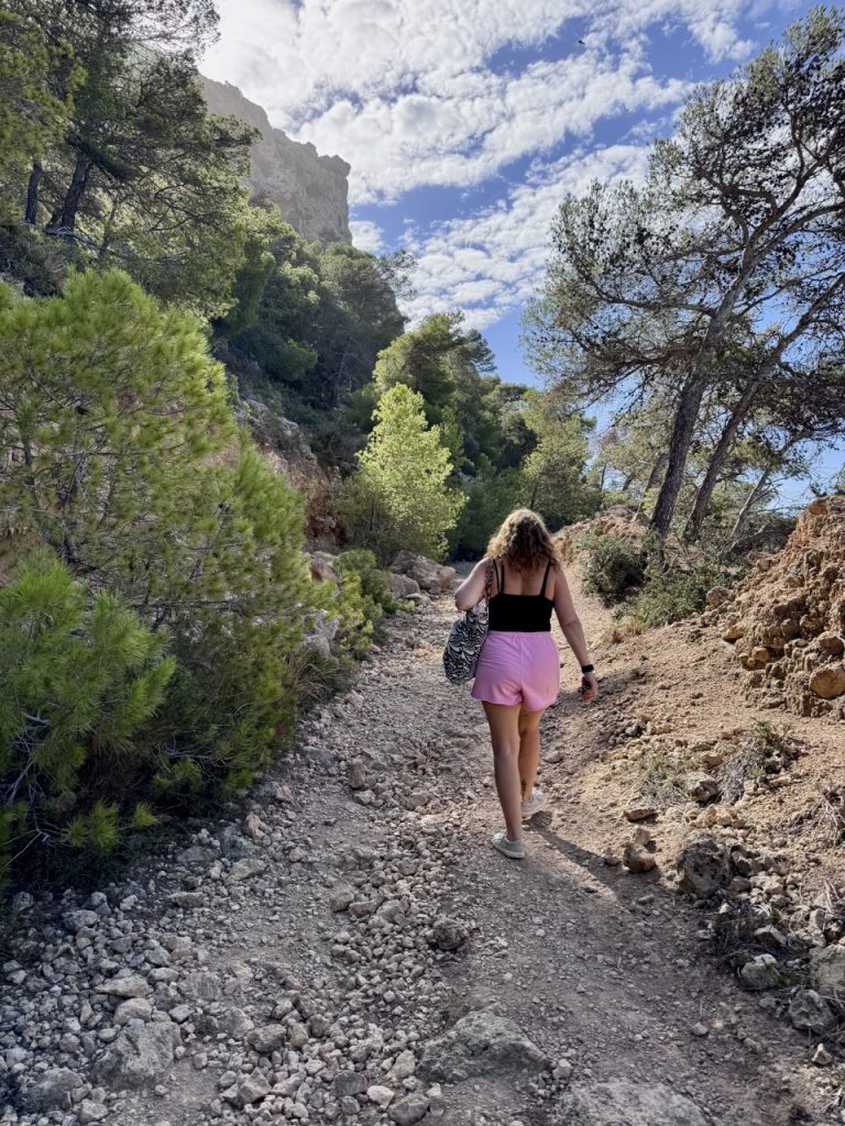
It soon became clear that the actual hiking trail to Cala d’Egos is not clearly marked – there are no signposts and the obvious main path soon gets confusing as it branches into other smaller paths leading off in different directions.
For a first-time visitor to this hiking trail, it’s difficult to figure out exactly where you need to go.
Luckily, we had found this trail via the hiking app Alltrails which you should definitely download to your phone prior to doing this hike, as it gives you very clear directions and a very detailed map that you can easily follow (no such map exists on Google Maps, you specifically need the marked hiking trail map on the Alltrails app, which is a paid-for app but gives you a free trial period).
The terrain on this Port Andratx hiking trail is fairly rocky with a few relatively steep climbs and descents, but nothing overly-technical or challenging / dangerous.
What I love about Mallorca is that you can easily go from busy, lively tourist resorts to wild, remote countryside – and certainly walking this trail early on this October morning, we were able to enjoy absolute peace and quiet, with just the sounds of birdsong and the distant lapping waves of the Mediterranean sea. It was absolutely superb.
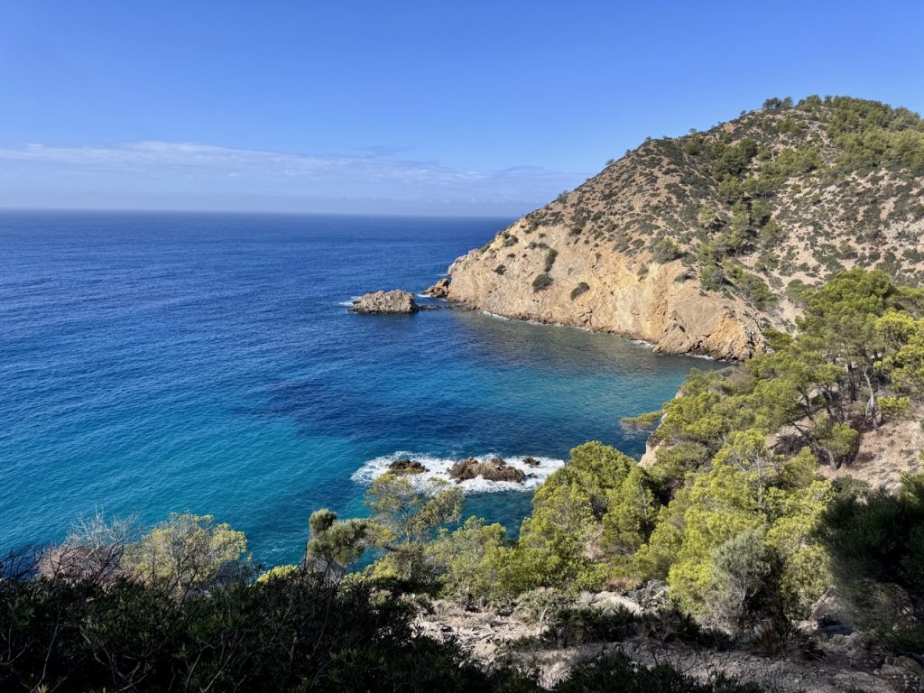
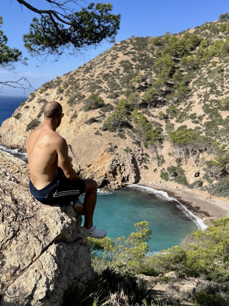
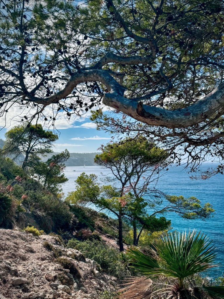
After some time, the forest opens out to reveal breathtaking views of the rugged coast and the sight of the remote Cala d’Egos beach below.
From high up on the cliffs, you’re treated to views of the stunning cliffs dropping down into the crystal clear blue water beneath; the bright green pine trees contrasting against the clear blue sky; it’s some of Mallorca’s natural beauty at its absolute best.
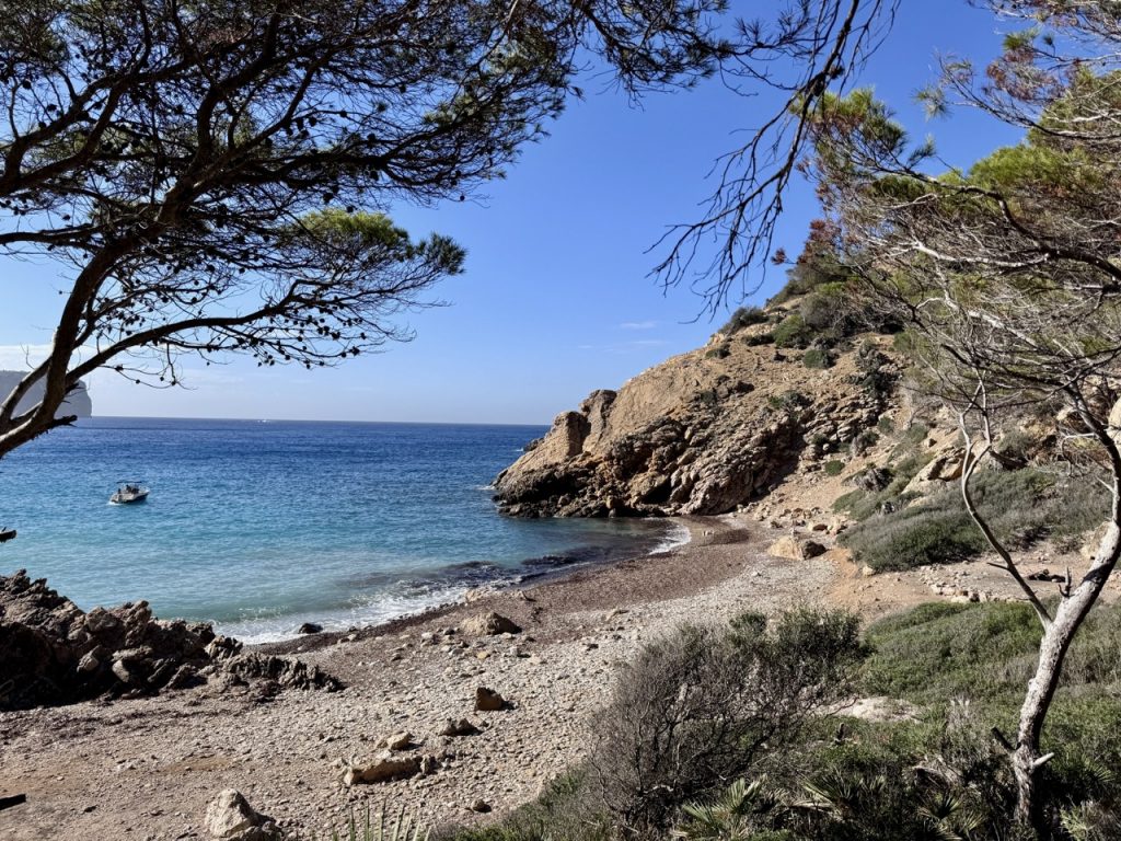
We followed the path down to the beach, which is a completely wild beach with no facilities and no access other than this hiking trail or by boat.
We were literally the only people here, having the entire beach totally to ourselves.
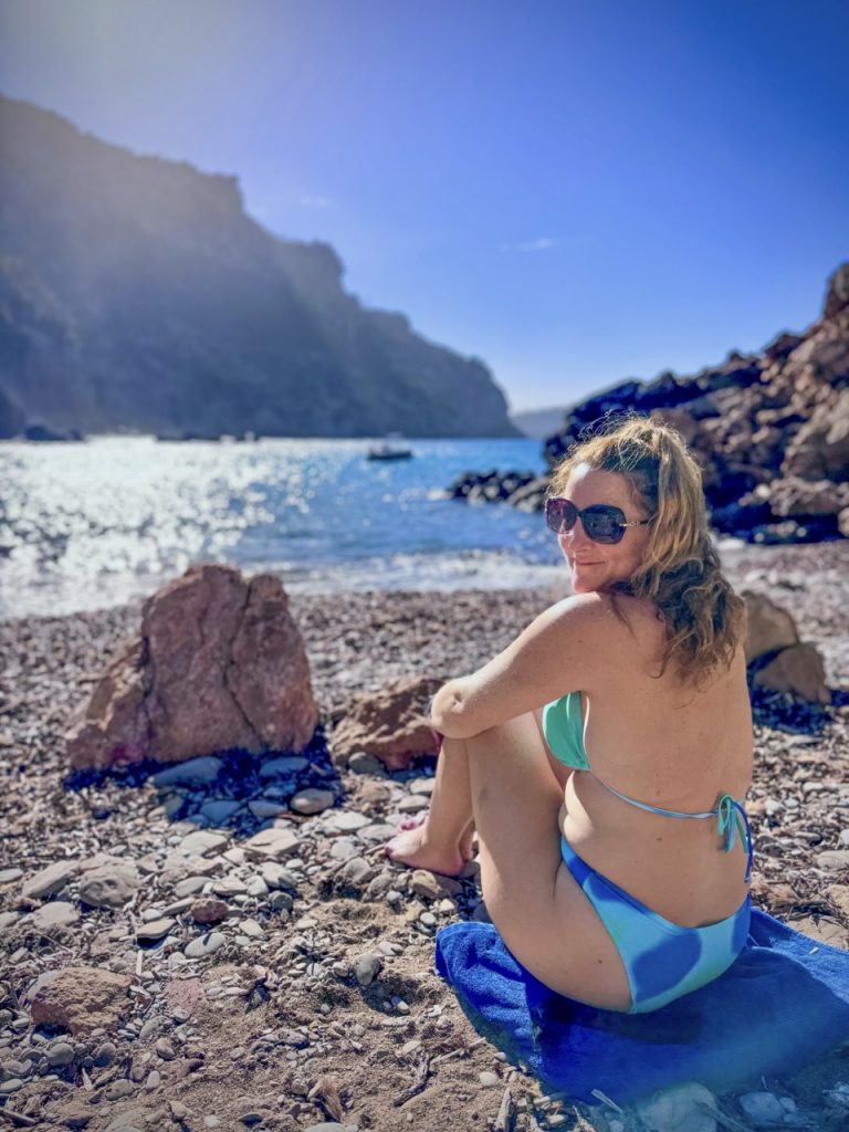
It’s a stony beach rather than sandy, but still comfortable to lay on – and the sea was as clear as glass all the way to the bottom; extremely inviting to cool off in after the walk here in the hot sun.
We spent an hour or more on the beach, relaxing, enjoying the tranquil peace and quiet and swimming in the sea before heading back up to the hiking trail and continuing on the circular route back up the cliff-side and into the forest again.
The whole way back we had amazing views over the coast and cliffs, constantly slowing us down as we had to stop every couple of minutes to enjoy and photograph the views.
Eventually the Alltrails app took us back to where we’d left the car, in time for us to drive down into Port d’Andratx for a lunch in the glorious sun in one of the port’s many waterside restaurants.
Details of the Port d’Andratx hiking trail to Cala d’Egos…
The specific route page on Alltrails is here, which will direct you to the start of the hiking trail, however the start point on the app is about half way up the hillside, which you can actually continue driving much further up.
If you’re driving, we would definitely recommend ignoring the Alltrails app start point and carrying on up the switch-back road as far as you can drive.
The walk up this part of the trail is a long, uphill drag without much to see and you can cut this part of the walk out completely by simply driving on up the road, which eventually reaches a dead end and has various road-side parking spots alongside the forested area where the hike actually gets interesting.
Another tip we picked up from the comments on the Alltrails app was to walk the route in the opposite direction to that suggested on the app (i.e. walk it anti-clockwise rather than clockwise).
It’s just slightly technically easier in that direction and also means you complete the longest leg of the walk first, before reaching Cala d’Egos beach, and therefore have the shorter leg at the end after you’ve had time to rest and recover at the beach.
Alltrails suggests the total time for the circular hiking route is 2-hours, but we were actually only walking for about 1hr and 15-minutes, largely because we’d cut out the long drag at the start as described above and probably also because we’re quite fast walkers.
And the total distance we walked (cutting off the first climb) was 2.5-miles.
We did the walk in the morning, aiming to avoid the hottest part of the day (although it was October, temperatures were still 30-degrees or so when we were here) and it was perfect timing to spend the whole morning on the hike, at the beach – and then getting us back to Port d’Andratx to reward ourselves with a long lunch at one of the many restaurants there.
Location links
- Google Maps link: This is the start point suggested by the Alltrails app but if you’re driving here, our recommendation is carry on up the narrow, switch-back road, past the gates of various villas, until you reach the dead-end, where the start of the more interesting part of the trail can be found.
- Cala d’Egos beach location on Google Maps: This is where you’ll stop about half-way around the circular trail for a well-earned break at a beautiful natural cove beach.